Home / Islands / Kurahashi-jima
Kurahashi-jima 倉橋島

| Island group | Hiroshima Bay |
|---|---|
| Prefecture | Hiroshima |
| Region | Chugoku |
| Municipality | Kure |
| Area | 69.46 km² (26.8 mi²) |
| Highest point | 491 m |
| Coordinates | 34.13333° N, 132.51667° E |
Getting there: the article below outlines this island's usual ferry and flight routes. Timetables change with the season and sailings are cancelled in rough weather — always confirm the current schedule with the operator or the municipality before you travel.
Kurahashi-jima (倉橋島), also called Nagato-jima (長門島) in ancient texts, is an island in Hiroshima Bay located in southwestern Hiroshima Prefecture, Japan.
Geography
The island is roughly T-shaped, with the northern, most mountainous lobe sandwiched between mainland Kure and Etajima island.
Transportation
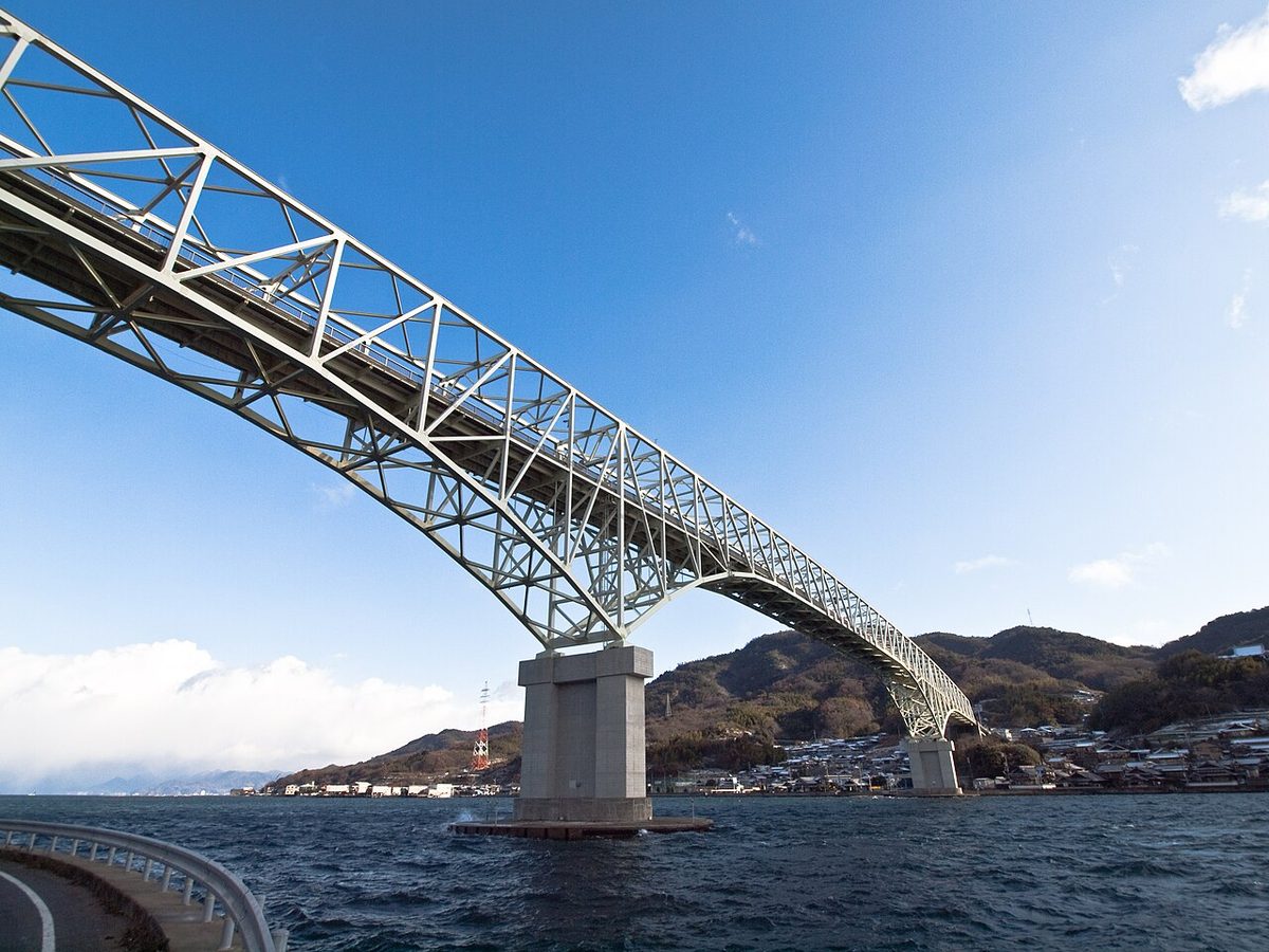
The island is connected to mainland of Honshu by a pair of bridges over 80 meters wide strait. The island is served by the national route 487. Also, travel by bus is possible since 2005.
Attractions
- Katsurahama - one of the Top 100 beautiful forests of Japan
- Kurahashi shipbuilding museum
History
- 7-8th century - a major center of shipbuilding and port for Yamato period Japan
- 13th century - an outpost against Wokou pirates for Kamakura period Japan
- 1709 - island comes under government of Hiroshima Domain as an important stopover on the trade route to Kaminoseki
- 1860 - coastal artillery fort is built
- 1 April 1889 - establishment of Kurahashi-jima village
- 1890 - with the assignment of island to the Kure Naval District, the access to the island is restricted
- 1 June 1952 - Kurahashi-jima village status is upgraded to "town".
- 4 December 1961 - first bridge connection to the mainland
- 1973 - bridge connection to Etajima
- 2005 - Kurahashi town merged into the expanded city of Kure
Notes and references
- ^ 呉市概要
- ^ 長門の造船歴史館
- ^ 広島県の島>安芸群島>倉橋島(くらはしじま)
- ^ 倉橋(長門)島
- This article incorporates material from Japanese Wikipedia page 倉橋島, accessed 14 August 2017
Text adapted from the English Wikipedia article Kurahashi-jima by its contributors, licensed CC BY-SA 4.0. Population, area and location facts from Wikidata (CC0); figures Wikidata does not carry are taken from the Japanese Wikipedia article's data table (CC BY-SA 4.0).