Izushima 出島

| Island group | Sanriku Coast |
|---|---|
| Prefecture | Miyagi |
| Region | Tohoku |
| Municipality | Onagawa |
| Area | 2.62 km² (1.01 mi²) |
| Coordinates | 38.45° N, 141.525° E |
Getting there: the article below outlines this island's usual ferry and flight routes. Timetables change with the season and sailings are cancelled in rough weather — always confirm the current schedule with the operator or the municipality before you travel.
Izushima is an island belonging to the Miyagi Gyreg County. It's also the administrative district in the north of the island. The island is area 2.63 square kilometers, around 14 kilometers, altitude 87 meters. At its peak, about 1,800 people lived, but by the end of November of 2019, the population of Japan had dropped to 77 by the end of the year, due to overseasing and the effects of the later Tokyo earthquake. The population of the earthquake was 450 people.
Geography
Izushima is an island about 300 meters east of the mainland, 38 degrees, 27 minutes, 0 seconds north, 141 degrees 31 minutes 30 seconds east. After being designated in 1979 as the South Three-Tree-Yung National Park, it was designated in 2015 at the Thirdland Rehabilitation National Park. Because of the dark tide, it is mild compared to the mainland. Little snow falls. In the north of the island is a Izushima and a temple precinct in the south and a Miyagi track in between. The temple is a village separated from Izushima. The Izushima was formed in the cove, so it had no water and had to rely on the rain water, whereas the temple had to be built in front of it. In a national survey, the Izushima district has 25 families and 17 temple districts. People have lived long enough, and there is the largest zXQ144X snail population. The Izushima site is well known, and is an island full of archaeological romans. The area around the island is a fine fishing ground called off the coast of Mount Gyang, the world's largest fishing resort. The island's basal industry is centered around the water industry and is particularly rich in coastal fishing and shallow-sea farming. There's also a lot of fishing islands. The name Izushima was named in the sense "An island far from the interior."
History
The ruins of Izushima are thought to have been the site of life during the chain age. There is also a pharmaceutical chapel founded during the Civil War. It was prized as a shelter for ships operating on the South Coast. The development of the island began with the salt industry, but because of overgrazing the trees for fuel, the development of the island has been reduced to fishing. By the earthquake that occurred on March 11, 2011, in the Tohoku Pacific Ocean, housing on the island was almost destroyed, and the tsunami that cut off the life line and struck the island cost 25 island people. The tsunami was said to have been nearly 20 meters high. The residents ran up the mountain and took refuge in the fourth grade school of Women's Bank and the Second Central School. There was no way to contact the mainland, but one of the two satellite phones left on the island was contacted, and the next day all the people who survived were able to evacuate the island. The quay of two ports sank nearly three feet because of the earthquake. As of November 2011, fewer than 100 returned to the island. The regular ship with Migawa Port is on two flights two days a week, and Izushima Clinic is closed. There hasn't been a second look at the Izushima Post Office or the Miyagi Fish and Fishing Department Izushima. On the restoration of the island, at Miyagi, a group of Izushimas and temples were assembled and presented to the residents the proposal to move them to the high ground. In addition to saying that the residents want to rebuild their familiar land, there was a reaction to the general transfer proposal, and the disaster housing was completed in the temple districts during the Izushima districts, 2015 level. There was a long bridge plan with the mainland, but the Izushima bridge project went ahead from 2017, and the Izushima bridge opened on December 19, 2024, a total of 364 meters.
Traffic
There was a bridge plan as a sightseeing and disaster escape route, as mentioned earlier, but construction was behind the plan. Then, beginning in 2017, the construction of the bridge was under way, and on December 19, 2024, "Izushima Bridge" was opened. This enabled us to connect in about 15 minutes by car from the center of Magawa Town. At one time, there had been a high-speed ship to Eshima, the Shepard River, at the port of Izushima, arriving at the port of the Temple. However, on March 30, 2025, the port of both ports ended. The following day, March 31st, the Izushima line, which connects Izushima to the ZX87X station.
Life
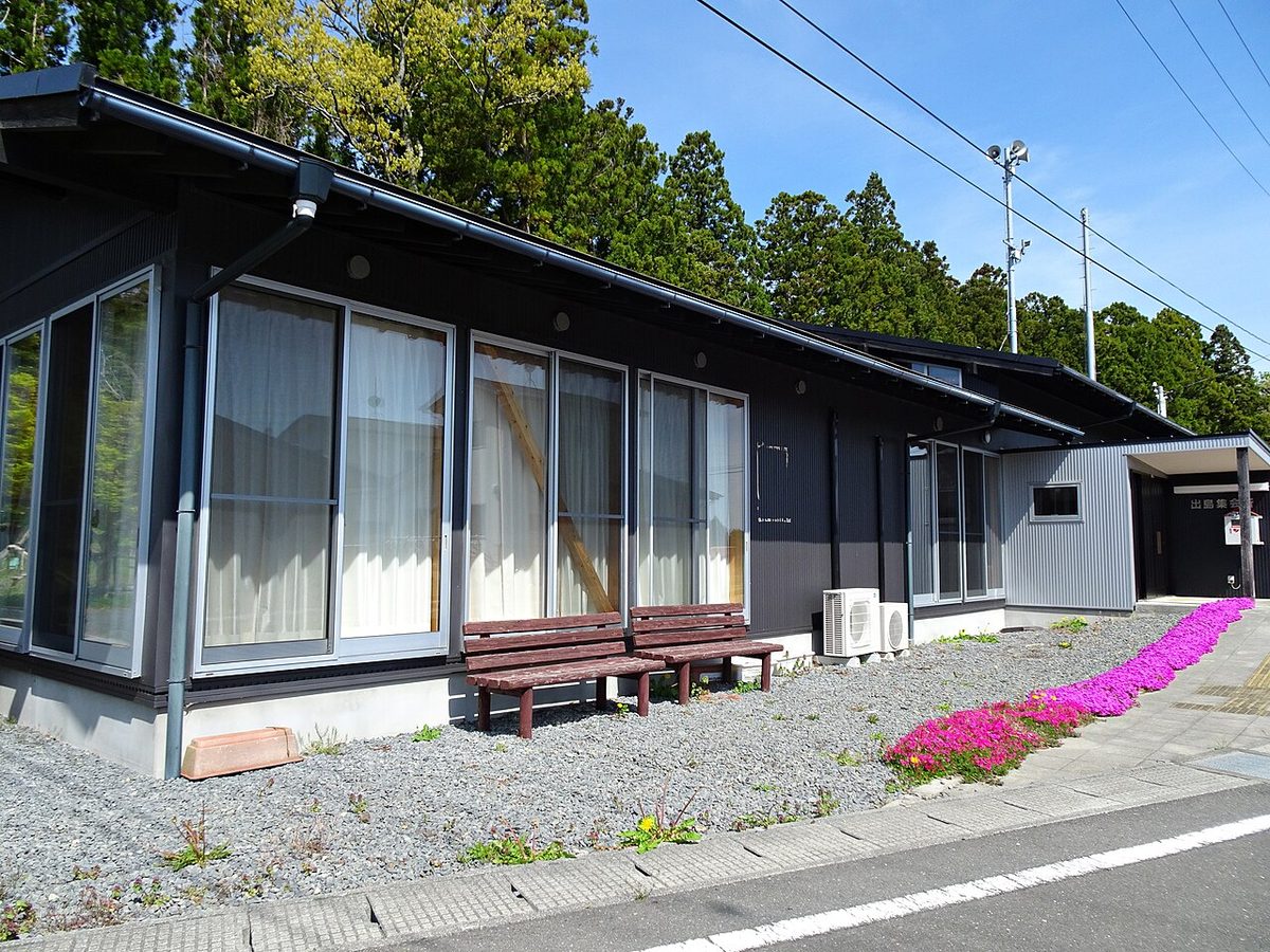
Public agency - the Izushima Development Center as the source and destination of Magawa Town. Education agencies--no. At one time, there was a second-class school, the fourth elementary school in Women's Bank, and the second-class school in Shiragawa. However, after the earthquake, the schools were closed and there were also teachers' houses. (It was in the mountain at the middle point between Izushima and temple). Before the earthquake, there was a Izushima nursery in the temple. The post office - Izushima Buildings began to flow in the tsunami caused by the earthquake, and now it's closed. The shop - before the earthquake, there were two houses in one of the temples and in Izushima. The dining room--no. The gas station--no. At one time, it was in a temple, but the building was flooded by the tsunami caused by the earthquake. The last stop after the bridge requires a walk to the center of Magawa Town. The financial agency - the Miyagi fishing plant. - No. There used to be only one Izushima. It was shut down in 2017 and resumed in March 2018, but closed in August 2024. After inheriting the business, I'm going to resume after 2025. Medical institutions--no. There was Izushima Clinic (ZX87X) National Health Insurance (Izushima), but when the earthquake hit the building, it is now closed. Twice a month, twice a month to the bridge, the director of the Women's Town Hospital was on board a boat owned by a woman's town and conducted interviews at the assembly hall of the temporary building. The emergency is carried by a Miyagi flight helicopter from a fishing boat or a school's baseball field. A broadcast - Analog TV broadcast is not suitable to be received directly from local relationships, but it has a hearing facility on the island, so I was able to watch well throughout the island. The radio can be received without a problem. Electric telephones-- they're fully ready. It's an air line in the Channel and supplies the island. The fixed phone has a new Izushima exchange shop on the island. Also, since the Izushima bridge above is built with water, electricity, credited plumbing and wiring, it will provide for you after construction. Cell phones are all over the area. The water supply is coming from the mainland, but the problem is decomposing. But since the Izushima bridge above is equipped with water, electricity, and trust pipes, it is possible to get rid of the supply after construction and be solved about aging. The urine garbage - all brought to the mainland.
It's a tourist spot
Izushima site. Apothecary. (There's the Buddha's statue of Nintendo.) There was a fog whistle between 1936 and 2010.
- For example, the festival
The Izushima is the Eight-Sun Deity, and in the temples, it's the Duishima shrine, each held on the 2rd and 3rd Sunday of May each year.
Tradition
(Single wind) - he's teaching his children to leave behind with the traditional lioness that goes to the island.
It's a masterpiece
Mebar. Umitanago. I'm sorry. Shells.
It's called a stage land, Izushima
The radio documentary "There Will Be a Bond of the Island Tomorrow" will be presented at the fourth grade school of Women's Street, Japan, closing. It was broadcast in November 2012 in Ev eme Aomori and elsewhere.
Text adapted from the Japanese Wikipedia article 出島 (宮城県), whose full text was translated into English for this guide by its contributors, licensed CC BY-SA 4.0. Population, area and location facts from Wikidata (CC0).